Showing posts with label Fortress. Show all posts

Wednesday, 21 December 2022

Atlit Castle and Khirbet Karta

The day that we went to see the flamingos in Atlit we also took a walk along the beach to view the ruins of the Crusader fortress Château Pèlerin, also known as Atlit Castle. Built in 1218 by the Templars and taken over by the Mamluks in 1291, it was one of the largest fortresses in the Holy Land. The fortress was built on a promontory, with two main walls cutting the citadel off from the land and a protected harbour on the south side of the promontory. It also had three fresh water wells within its enclosure. 
Château Pèlerin was not demolished by the Mamluks, as was their normal practice after capturing a Crusader fortification. It in fact remained intact for several hundred years, until suffering damage in an earthquake in 1837.
Aaron Aaronsohn (a Jewish agronomist, botanist and head of the NILI espionage group) established an agricultural station at Atlit in 1911. Château Pèlerin became an important observation point used by the NILI spy team in transferring data to the British during World War I. The NILI spies would make contact with the British who would sail by. The British would send a small boat in to shore in the middle of the night to give gold coins to support the Jewish effort and in return would get detailed plans of Turkish movements. These interactions with the British Intelligence played a part in General Allenby's successful defeat of the Turkish army in Israel in 1917.
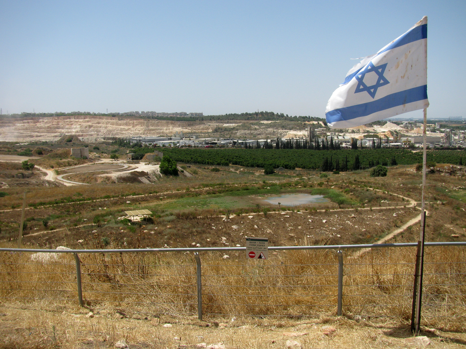
Today the fortress is an Israeli Navy base and the headquarters of the Shayetet 13 naval commando unit. As a result, it is within a closed military zone and we were only able to view it from the beach.
We were however able to explore the large Crusader cemetery south of the fortress. The cemetery dates from the 12-13th century and has more than 1,700 graves, above and below. Knights, pilgrims, residents and professionals working on the fortress were buried there and some gravestones are decorated with stylized patterns of crosses and icons indicating the status and profession of the deceased.
I read that the best place to view Château Pèlerin was from the viewing terrace at Khirbet Karta, so that was our next stop. We parked in the Limor picnic area, named after a member of the Genio family who founded the salt works in Atlit, and walked up to the viewing point which was once a British Mandatory water tower. The views of the salt ponds full of flamingos and other migrating birds, the Mediterranean Sea and Mount Carmel were wonderful. To the north we could see the ruins of Château Pèlerin and Le Destroit.
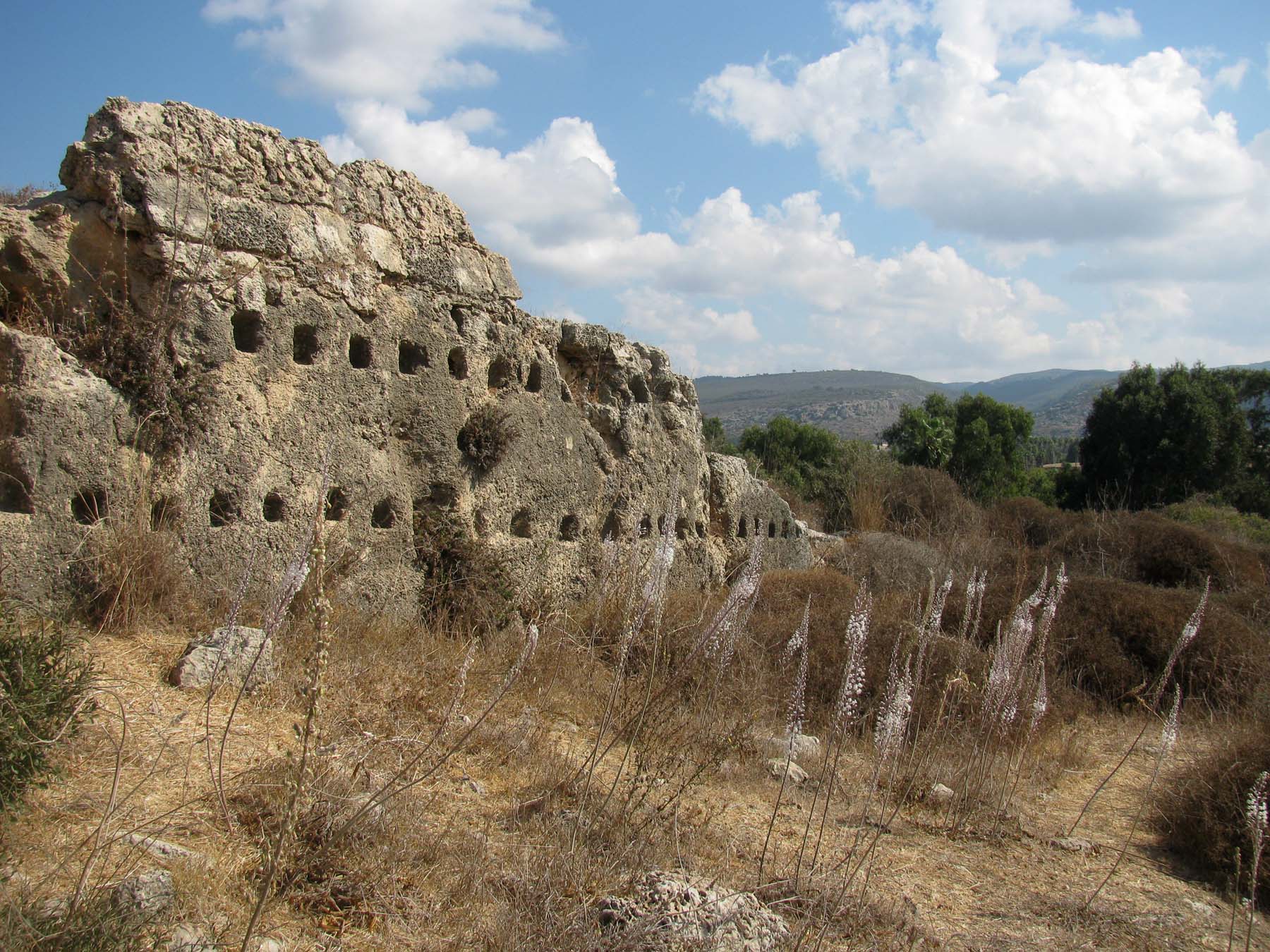
Le Destroit was a Crusader fortress which preceded Château Pèlerin. It was built sometime in the 1100s to protect Château Pèlerin and to secure the convoys that traveled along the sea. It was demolished by the Crusaders themselves about a century after its founding. The reason for this was the Crusaders' desire to avoid a Mamluk siege on the tiny fortress, which count not withstand it.
The Crusaders called Le Destroit Districtum and in French Destroit. The Hebrew name, Khirbet Karta, is related to the Hebrew churvan, meaning desolation or a destroyed place. Karta, which is taken from Aramaic and used today in modern Hebrew, means city, which this place does not really seem to have been.
Excavations inside the fortress and the surrounding area revealed water cisterns and the remains of clay pipes used to collect rainwater. To the north of the fortress are the remains of horse stables, below. There is a row of cavities, which were probably used for tying the animals. On the southern side of the stables, there is a row of sockets in the wall that were likely used to support the beams of a wooden roof that covered the place.
Further along we saw a guard booth hewn from sandstone and on the vertical, eastern quarried wall of the fortress, a large ancient inscription which has been cut into the rock. The letters are Phoenician script, probably the first two signs of the name of the Phoenician settlement.
Khirbet Karta is one of those sites that draws large groups of flower lovers every year, to view hundreds of blooming sea squills in one spot. Sea squills bloom at the end of August and September and into October each year, depending on the area and temperature. The blooming occurs earlier in the colder areas and later in the warm places. It just so happened that we visited Khirbet Karta back in October, when the flowers were in full bloom!
The sea squill is a common plant that stands out in the landscape. It is special due to its lifecycle and structure: its onions, its leaves, its flowers and its toxic materials. In November it grows leaves which last through the winter and early spring. By April the leaves wilt and all above-ground parts of the plant die. At the end of the summer a single flowering white pillar without any green leaves rises for just a few weeks. This can grow up to two meters high. The flowering begins from the bottom of the high flower pillar and every day another group of about 30 flowers opens above the previous ones, and the flowers that opened the day before wilt. The flower opens at night and remains open for approximately 18 hours.
The fact that the plant produces leaves in the spring and flowers in the fall is a way to survive the Mediterranean climate because the summers here are so hot and dry.
In Hebrew the sea squill is called Hatzav, from the root meaning "to chisel" because this hardy flower chisels itself into rock. The Jewish sages mentioned that Joshua used the sea squill to mark the borders of the Land of Israel. The plant's toxicity deterred people from digging up the bulbs to move the boundaries. The Egyptians referred to the sea squill as Ein Sit, the god who resists the sun, because it only blooms in the autumn.
The sea squill is one of the rare poisonous plants in Israel and one should not touch the bulbs without wearing gloves. It is related to the onion and, just as onions causes your eyes to burn when you chop them, sea squill leaves contain burning needle-like crystals. The flower was often used to protect graves in Arab cemeteries so that predators like wolves, jackals and hyenas wouldn't dig up the corpses. The flowers are thought of as messengers and are known as basl el maytin (bulb of the dead).
A folk saying across the Middle East and North Africa goes "The sea squill blooms and the summer ends". The sea squill may only bloom for a short period but it is one of the most beloved plants here in Israel. Children are taught to look out for it and the plant even has its own song, כמו חצב, written by Naomi Shemer, one of Israel's leading songwriters.

Thursday, 2 September 2021

Migdal Tsedek National Park

Some weeks ago Mister Handmade in Israel and I visited Migdal Tsedek National Park. The park encompasses a tomb, agricultural installations, quarries and a spectacular Crusader fortress that became an Arab manor house during the Ottoman period. It was officially declared a national park in 1994 and, after more than a decade of conservation work, opened to the public this year.
The Migdal Tsedek fortress is located at the top of a hill, overlooking the "Afek Passage", part of the ancient Via Maris trade route. The Via Maris dates from the early Bronze Age and linked Egypt with the northern empires of Syria, Anatolia and Mesopotamia (modern day Iran, Iraq, Israel, Turkey and Syria). "Via Maris" means "Way of the Sea" in Latin. The historic route passed through Israel along the Israeli Mediterranean coast, and then onto the road to Jerusalem and Jericho, both important trade routes along the Mediterranean. Over time two fortresses were built on both sides of the Afek Passage. From one side there was the Yarkon National Park – Tel Afek (Antipatris), and from the other Migdal Tsedek (also known as Migdal Afek and, during the Crusader period, Mirabel, which means "beautiful view"). Migdal Tsedek means "Tower of Sadek" in Hebrew, referring to the name of its Sheikh, Muhammad al-Sadiq al-Jamma'ini.
In the Second Temple period a Jewish settlement called Migdal Afek was situated in the area of the national park. It was apparently destroyed by the Romans in the Great Revolt (one of three major Jewish rebellions against the Roman Empire). During the Crusader period a magnificent fortress was built on the hilltop. In the 12th century it was captured and destroyed by the Ayyubid army under the command of Saladin. Muslim sources in the 13th century describe the fortress as a village called Majdal Yaba. The village was one of the largest villages built along the line between the Samarian foothills and the coastal plain.
In the 17th century the village was renamed Majdal al-Sadiq after Sheikh Muhammad al-Sadiq al-Jamma'ini, the chief of the village who hailed from the prominent Rayyān family. They arrived from Transjordan and built a two-story manor house on the remains of the Crusader fortress. His rule was brief but his architectural influence can be seen to this day. The manor house contained some 60 rooms and courtyards. The ground floor was fronted by a large courtyard with space for animals and storage, and the top floor had four apartments in which the sheikh and his family lived.
By the 19th century the fortress, now known as the "Rayyān Fortress", was in ruins and the village ceased to be a centre of power.
During World War I, Majdal Yaba was the site of battles between the Axis troops, (forces of the Ottoman, German and Austro-Hungarian empires) and the British army. It was captured by British troops on the 9th of November 1917. 
Between 1937 and 1947 there was a labour camp at Migdal Tsedek. Yitzhak Sadeh, who became the first commander of the Palmach (an elite fighting unit of the Haganah, the underground army of the Yishuv (Jewish community) during the period of the British Mandate for Palestine), established the force of Jewish policemen known as the Notrim at Migdal Tsedek. They worked under the British police force during the Arab Revolt, protecting Jewish settlements, factories and the roads.
The activities of the Notrim allowed the stone industry at Migdal Tsedek to operate. The number of quarries in the area increased and the stone industry flourished. At its height some 35 lime kilns and stone quarries were in operation in the area and several attempts were made to establish a Jewish community where the quarry workers and their families would live a pioneering life.
However, when Israel's War of Independence broke out, the security situation worsened. It was decided to end Jewish labour in the Migdal Tsedek factories and withdraw the Haganah fighters. Iraqi forces took over the lime kilns and stone quarries. 
On the 12th July 1948, Battalion 32 of the Alexandroni Brigade captured Migdal Tsedek in Operation Betek. The town of Rosh Ha'Ayin was established on village lands in 1949, and in 1953 Kibbutz Givat HaShlosha was moved to its current position, on the land of the newly depopulated village of Majdal Yaba. When Holocaust survivors arrived in Israel, the kibbutz absorbed many young people.
In the 1970s the quarries, above and below, became neglected and were turned into rubbish dumps. Conservation and restoration work began at Migdal Tsedek in 1993. Original materials and ancient construction technologies were utilised as much as possible. The fortress's gatehouse and parts of the upper story were restored, along with the Crusader moat and a Crusader street. The entrances to the courtyards and the rooms once featured decorated lintels, most of which were stolen during the 1970s and 1980s. In 2014 the lintels were restored and reworked according to old photographs.
Migdal Tsedek National Park is still in the process of development. In the future, walking trails to the quarries and lime kilns, to the sheikh's tomb and to three winter pools that fill every year with rainwater from surface runoff are planned. The pools attracts various species of birds and animals including including the European green toad, Savigny's tree frog and the Levant water frog. Animals living in the park include striped hyenas, golden jackals, red foxes and gazelles. Migdal Tsedek is also on the migration route for millions of birds every year.

PoCoLo