Showing posts with label springs. Show all posts

Sunday, 8 February 2026

Tel Kesalon

On a beautiful day in December we decided it was time for us to start hiking again. We used to hike often, especially during the COVID-19 pandemic, but since losing Gadi it has been hard to find the will. The bright sunny weather on this particular weekend gave us the extra push to get up and start walking, along with the knowledge that Israel's winter flower season was just beginning.
I chose a short but beautiful hike on Tel Kesalon, in the Jerusalem Hills. Kesalon is a biblical site mentioned in the Book of Joshua as part of the northern border of the territory allotted to the tribe of Judah:
Then it curved westward from Baalah to Mount Seir, ran along the northern slope of Mount Jearim (that is, Kesalon), continued down to Beth Shemesh and crossed to Timnah -  Joshua 15:10
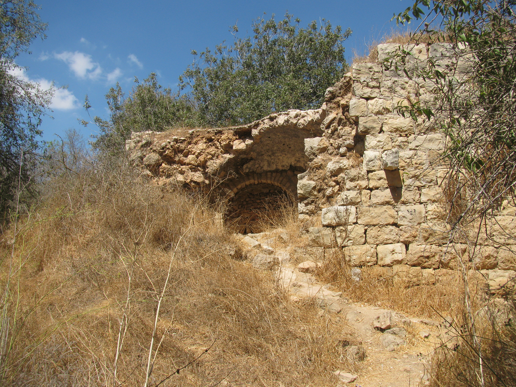
Kesalon was a large Jewish village during the Roman period in Israel. In 1596 Kisla, as it was then known, was a village in the subdistrict of Ramla with a population of sixty-one. It paid taxes on wheat, barley, sesame, and fruit trees as well as on goats and beehives. Most of what is visible on Tel Kesalon today is the remains of an Arab village called Kasla, which was conquered during the War of Independence in 1948. The ruins, including crumbling walls and terraces, add a historical charm to the natural landscape.
The nearby modern moshav of Kesalon, founded in 1952, is named after this site. New immigrants from Yemen, brought to Israel in Operation Magic Carpet, were given farmland there, but abandoned the moshav a few years later to join members of the Yemenite community living in Rosh Ha'ayin. Their place was taken by Jewish immigrants from Morocco.
We started our hike by climbing the tel itself. A tel is a mound or small hill that has been formed over time by layers of settlement. The view from the top, of Moshav Kesalon on one side and Moshav Beit Meir on the other, was fabulous. A Jewish National Fund forest was planted around Tel Kesalon and the surrounding area, named Ya'ar Hakdoshim (Forest of the Martyrs). It commemorates the victims of the Holocaust and contains six million trees, symbolizing the six million Jews who perished. Planting began in 1946 and memorials for perished communities are set throughout the forest. There are various springs in the area and the Kesalon stream passes on the north side of the hill, more than 200m below the summit. Almond trees grow on top of the tel and cactuses grow along the site's southern slopes.
We climbed back down Tel Kesalon and began our hike. I immediately spotted pale pink sitvanit hayoreh (Steven's meadow saffron), one of the first flowering plants of the autumn, and clusters of rakefot (Persian cyclamen). As we hiked further along the path I glimpsed karkom (winter crocus) and bunches of white narcissus blooms (Narcissus tazetta or Paperwhite) growing among the rocks. We passed a spring, its water tinted green by algae, and headed towards Ein Kesla, a stone pool carved around a natural spring. In late December the pool was still dry.
After a while it was time for us to retrace our steps and head back towards Tel Kesalon and our car. The rocky path along the side of the valley was precarious at times, but the views over the deep valley of the Kesalon stream were once again breathtaking. We then returned to the path we had started our hike on, but this time it circled around the other side of the tel, ultimately reaching the hilltop where we had started out earlier in the day.
It was time for lunch in one of the many picnic areas of the Forest of the Martyrs. Although it was December, just a few days before Christmas, the pleasant weather had drawn many people outdoors. As we picnicked, we spoke about Gadi and how much he would have enjoyed the hike. Pushing ourselves to return to the great outdoors felt right, and we were glad we had taken that step.

Thursday, 16 November 2023

Shvil HaMaayanot

Israel is at war and we are living through sad times. I have posted a couple of blogs about the situation but have decided now to share some posts about the beautiful side of the country I live in. A country filled with nature trails and historic ruins, gorgeous birds and flowers. The posts were written a year and a half or even two years ago, before I lost my youngest son. I haven’t felt like sharing them but now think that the time is appropriate to show you another side of Israel, a side that you will not currently see on the news.
This is Israel.
I am really not sure why it took me so long to hike Shvil HaMaayanot (The Springs Trail) in the Jerusalem Hills. It was the perfect route for me. The views over Nahal Sorek and its tributaries were spectacular and the spring flowers were at their very best. Perhaps the only downside was that the maayanot, springs, which give the hiking route it's name, were too full of swimmers for my liking, due to it being the Passover holidays. No matter, I will just have to hike the route again!
We passed several springs on the trail, just some of the many small hidden springs which flow out of the hills to saturate the surrounding vegetation. Over the years, man has learned to cultivate the water from these underground springs to irrigate agricultural areas. Villagers would dig tunnels into the rock to obtain a flow of water. The pools in front of the entrance to these tunnels became small reservoirs, used to supply drinking water to livestock and humans. Sometimes the water would be directed downhill from the pool by aqueducts to irrigate vegetable gardens. You can see terraces, now forested, on both sides of the trail.
The trail took us along the side of a mountain ridge and past several caves and springs and other cool things to explore. I dipped my feet in the cold water leading into one cave, then climbed out the back of it to continue on our way. Soon we reached the first big spring on the trail, Einot Uzi. It was clearly a warm weather favourite and was rather busy! We found a spot to rest and to enjoy a kosher for Passover snack, before returning to the trail. Our next stop was Ein Tamar, a shallow spring surrounded by a palm tree and a shaded picnic area. The spring is named after Tamar Natan, who died at a young age. The pool was built by her friends and other organisations.
We continued on the green-marked trail, stopping for a picnic with wonderful views and surrounded by beautiful flowers. It was a very hot day and we could have continued towards Moshav Even Sapir, on the last part of what is officially Shvil HaMaayanot, but at this point we decided to turn back. This time the hike was uphill and a little harder in the heat, but the flowers and views made it all worthwhile. I spotted beautiful red poppies, Pink Butterfly Orchids and some very late Persian Cyclamen. The pink and white rockrose, below, were abundant.
The trail starts near Yad Kennedy, a memorial to John F. Kennedy, the 35th President of the United States, who was assassinated in 1963 at age 46. This memorial was built 3 years after his death. It is shaped like the stump of a tree to symbolise his life cut short. The memorial has 51 pillars representing the 50 states of the union plus Washington DC. The emblems of the states are on the outside of each of the pillars. Inside the memorial is a bronze facial outline of John F. Kennedy, and in the centre of the memorial an eternal flame.
Also nearby are Horvat Saadim, the Seadim Ruins, which we visited back in 2020. The ruins were called Khirbet Sa'ida, which means "Fortunate Woman Ruins" in Arabic and are the remains of a Byzantine agricultural farm and an ancient mosque. They can be visited - if you still have the energy - before returning to your car.
* This post has been shared on Little Things Thursday and Wordless Wednesday (on Tuesday).
PoCoLo
Sticky Mud and Belly Laughs

Thursday, 2 December 2021

The Hanut Ruins and Ein Mata

The Hanut ruins or Khirbet Hanut ("ruins of the rest place") is an archaeological site on the side of the main road from Beit Guvrin to Jerusalem. In the Byzantine period it was believed to mark the site where Goliath was buried. Excavations carried out at the site in the 1980s uncovered a Byzantine period church with a colourful mosaic floor. The Mamluks turned the church into a khan or inn known as Khirbet el-Khan, where travellers could spend the night as they made their way to Jerusalem and Bethlehem. A number of interesting artefacts have been uncovered at the site that help us understand how significant this place was at various moments in history.
A large water storage pool from Byzantine times is the first thing we saw at the site, above. The thick walls of the pool were built from large stones. The gaps between the stones were filled with smaller stones or cement. After that, the walls were plastered so that the water in the pool would not leak out.
During the Byzantine period many such pools were built in the Judaean Hills. They collected water for drinking and for irrigating orchards. This pool was the primary source of water for the khan or roadside inn.
Further along are the ruins of the Byzantine church. The floor of the main hall, which was uncovered in 2016, is covered with colourful mosaics illustrating geometric forms, grapes and icons of animals. It is 10x4.25m in size and is based on 1×1cm stones. The eastern edge of the mosaic contained a two-line black and white dedicatory inscription in Greek. It was removed in order to safeguard it. The mosaic was probably the victim of iconoclasm in ancient times. The human and animal figures were destroyed by people who were against the images of humans on public spaces. Based on the Greek inscription the final completion of the church can be dated to 563, 568 or 593 BCE. The church was most likely destroyed in the 8th century BCE.
To the east of the church there is a small crypt. Excavations have revealed an entrance and steps leading down into the narrow chamber of the crypt. Inside excavators found evidence that a single sarcophagi or coffin was once located there, as indicated by its negative imprint.
Next to the church is a large winepress installation from Byzantine times, above. The winepress is composed of 3 levels. On the top level, the floor is paved with white mosaic that is probably a remnant of the 6th century Byzantine church floor. On the 2nd level is the large treading floor where the workers crushed the grapes with their feet. The 3rd level was a covered collecting pit, 1.75m deep, where the grape juice was collected after it fermented.
A short trail took us from the Hanut ruins down to the spring at Ein Mata. Ein Mata means "Spring of the Orchard". The spring is located in the valley of Zanoah and and is named after the nearby Moshav Mata. It was once called Ain Bint-Nuh, named after the daughter of Noah. The ruins of the Arab village of lower 'Allar, which existed here until 1948, are spread along the trail. Near the spring stands a Crusader structure named Salvatio, above and below. The roof is rib vault and the walls are thick. The structure was reused during the Mamluk and Ottoman periods.
Ein Mata is a small spring that is hidden under a cluster of carob and fig trees. It was a nice spot to stop for our sandwiches and to enjoy the shade. The spring itself is too small for a dip. Thick brush surrounds the spring and the irrigation channels, which once carried the water to the nearby fields. The terraced hills around the spring were once used for agriculture and are now filled with greenery: sweet and bitter almonds, olives, grapes, pomegranates, lemons, figs, walnuts, Syrian pears, carobs and hawthorns. 
Another natural spring, Ein Tanur ("Oven Spring"), is nearby but we somehow missed it! According to a local legend, Noah's oven stood there before the flood. When God destroyed the world, Noah's oven began spouting water, proving Noah's great commitment to God. When the flood was over and the water subsided, the oven forgot its original purpose and water continued to flow from it. When Noah passed by in his ark, he only saw the spring rather than his oven, so he continued his journey and finally landed on Mount Ararat.
From Ein Mata and Ein Tanur we followed the trail back up the hill to the parking area at the Hanut ruins where we had started.
* Editing to add that I have just learnt that in 2010 a terrorist attack took place in the Mata forest. Susan Logan, an American Christian, was murdered and Kay Wilson, a British-born Israeli citizen, was critically injured. Sadly this attack is an important part of the history of the area.

PoCoLo