Showing posts with label Animals. Show all posts

Sunday, 8 December 2024

Aegina

After four very busy days in Athens we were ready to take things a bit easier. We took the ferry from the mainland over to Aegina, one of the Saronic Islands of Greece in the Saronic Gulf, 27 km from Athens. Aegina was a major power in the classical Greek times and for a period Athens' main competitor. It was designated as the first capital of the newly formed Greek State, from January 1828 until December 1829, after the period of the Greek Revolution of 1821.
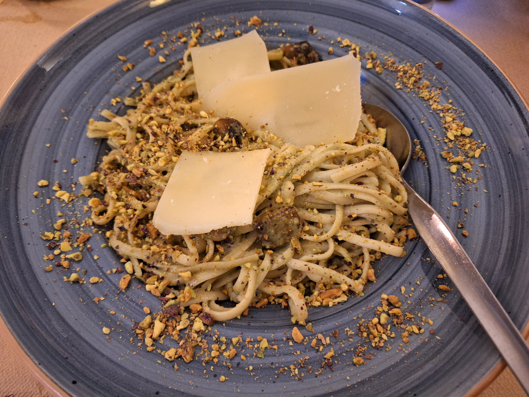
The island is essentially an extinct volcano. Two-thirds of it is rugged and mountainous, while the rest, in the north and west, consists of fertile plains. The island is renowned for its pistachios, and the Temple of Aphea, one of the most important in the country. The main town on the island of Aegina is also called Aegina. This is the capital and principal port and therefore pretty busy with tourists, hotels, restaurants and things to do. On the eastern side of the island is the village of Agia Marina, where we stayed. The village is named after the church of the same name that sits above it. 
We took a day off by the hotel pool before picking up our rental car, ready to explore the island. Our first stop was the Temple of Aphaia, located on a hilltop close to Agia Marina. Besides having a spectacular view, the temple is a very well preserved example of the Doric style and is the most important archaeological site in the Saronic islands and one of the most important in Greece. It was built in 480 BCE (on the site of an even older temple) when Aegina was at the height of its power.
There have been significant bronze, pottery and pediment sculptures found at the temple, including a marble sculpture of a fallen Hero and Heracles (Hercules) defending him with a bow and arrow. A large number of parts of the Temple of Aphaia were discovered in 1811 by English and German archaeologists, sold to Louis of Bavaria and finally ended up at Munich in 1828, where they have been exhibited ever since. In a special hall of the Glyptothek of Munich, named "Aiginetes", there are parts of the temple, a part of the relief sculptures, 17 statues, including a statue of Athena, and more.
Another place of interest on the island are the ruins of Paleochora, above, east of Aegina town. This was the capital of the island from the 9th till the 18th century, when villages were located inland to be safe from pirates. Aegina was one of the unlucky towns because it was destroyed once by the Ottoman pirate Barbarossa in 1537 and all the inhabitants were taken away as slaves. All that remains are a number of small churches in various states of decline, but it is a fascinating place to explore and one that I was very pleased to have visited. 
After our hike we stopped briefly at the nearby Monastery of Agiou Nektarou, apparently the most important religious monument of Aegina. The enormous new church holds the remains of Anastasios Kefalas, a hermit monk who died in 1920 and was the first orthodox saint of the 20th Century, canonized in 1961.
The following day we drove to the main town of Aegina. The place was buzzing with people enjoying the day in the cafes and tavernas. We walked along the busy waterfront, with its traditional fishing boats and guys mending their nets. The port of Aegina is a busy one with ferries, Flying Dolphins (hydrofoil passenger ferries), cruise ships, catamarans and fishing boats sailing in and out, depositing people, cars and fish. The pistachios produced in Aegina are famous all over Greece and are sold in small shops and booths in the town. We bought a couple of bags at a stand located close to the harbour. They were delicious!

Aegina town is a lovely little town with beautiful neoclassical buildings, thin narrow, winding streets, nice squares and brightly coloured buildings. North of the port of the town, on the top of a low hill, stands the remaining column of an ancient temple dedicated to Apollo. This site is called Kolona (column) and excavations have revealed various ruins, as well as a 5,000 year old settlement and layers of city life. A little museum displays the various interesting findings. Other sites worth seeing in the town include the Tower of Markellos, a watchtower erected in the late 17th century by Venetians as part of the greater fortifications that guarded the port, the Eynardeio Central School, a neoclassical building that stands next to the Cathedral of Aegina, and the fish market, situated in a road parallel to the waterfront.
Numerous cafes with views of the sea and the harbour operate along the waterfront. After a few hours exploring the town, we sat down for delicious pistachio gelato. It was the perfect way to end our day there.
We saved the best for last for our final day on Aegina. We drove south on the coastal road to the village of Perdika, above, a pretty village surrounded by gleaming blue seas. Spilling down from a hill and surrounded by a small bay, in the summer season Perdika is busy with visitors enjoying meals on the terraces of traditional tavernas. Moni islet is an islet close to Perdika and there are regular boat connections from the village throughout the summer months. The small boats disembark at a sandy beach on the north coast of the islet. After meandering along Perdika's waterfront, we hopped onto a boat which took us to Moni islet. Within 10 minutes we had reached paradise!
Moni islet is not inhabited, as there is no drinkable water. The only inhabitants are some deer, peacocks, Cretan Ibex and squirrels. The deer and the peacocks have grown especially accustomed to human presence and they greeted us as we disembarked. They clearly hoped we had something for them to eat!
Moni is the property of the Holy Monastery of Panagia Chrysoleontissa of Aegina - hence its name, "Moni", which in Greek translates into "monastery".  The islet was under the jurisdiction of the Greek Travel Club for 30 years, from 1960 to 1990. In 1962 it was decided that it should be a shelter for wild animals and access was restricted to only a few months per year through the small boats from Aegina, without the possibility for an overnight stay.
On the top of the islet's triangular peak, a crumbling structure reachable only by a strenuous hike is said to be the remains of a German lookout post. It has been standing there since World War II, when the Germans used Moni islet to defend the port of Piraeus from the Allies. We didn't hike to the lookout post but rather spent our time on the islet walking along the coast and swimming in the beautiful turquoise waters close to where we had disembarked. Moni islet has several small beaches suitable for swimming, especially on the north coast. These beaches are surrounded by gorgeous pine forests.
And then it was time to move on again, this time to the island of Agistri, just 14 km away.
Sticky Mud and Belly Laughs

Monday, 1 July 2024

50 Years of Incredible You

A customer wrote to me back in January 2023 to say that that her husband's 50th birthday was coming up. She knew that I wasn't working at full pace and wanted to know if I knew of anyone else who makes cards like I do. Of course, I don't! My cards are unique. I quickly realised that nice cards were important to this customer, so I decided to make one for her husband's special birthday.
My customer told me that her husband is into hiking and asked me if I could include hiking sticks, hiking boots and mountain views on the card. He also loves going on safari into the African wilderness and spotting wild animals. Leopard, springbok, cheetah, rhinoceros and elephant were the animals mentioned. Finally, she told me that her husband enjoys good Italian coffee.
I decided to show my customer's husband with a hot cup of coffee in one hand and a coffee pot in the other hand. Behind him are the mountain views that he loves so much. To his right is a springbok, a type of antelope found mainly in south and southwest Africa. The name "springbok" comes from the Afrikaans words spring ("jump") and bok ("antelope" or "goat"). It is the national animal of South Africa and has been adopted as a nickname or mascot by several South African sports teams, most famously by the national rugby union team.
On his left I added some walking books and hiking sticks, and an elephant, another of the animals from my customer's list. A big red number 50 marks his age.
"Thank you so much. It's great!" my customer wrote to me.
* This post has been shared on The Good. The Random. The Fun.
Sticky Mud and Belly Laughs

Thursday, 2 September 2021

Migdal Tsedek National Park

Some weeks ago Mister Handmade in Israel and I visited Migdal Tsedek National Park. The park encompasses a tomb, agricultural installations, quarries and a spectacular Crusader fortress that became an Arab manor house during the Ottoman period. It was officially declared a national park in 1994 and, after more than a decade of conservation work, opened to the public this year.
The Migdal Tsedek fortress is located at the top of a hill, overlooking the "Afek Passage", part of the ancient Via Maris trade route. The Via Maris dates from the early Bronze Age and linked Egypt with the northern empires of Syria, Anatolia and Mesopotamia (modern day Iran, Iraq, Israel, Turkey and Syria). "Via Maris" means "Way of the Sea" in Latin. The historic route passed through Israel along the Israeli Mediterranean coast, and then onto the road to Jerusalem and Jericho, both important trade routes along the Mediterranean. Over time two fortresses were built on both sides of the Afek Passage. From one side there was the Yarkon National Park – Tel Afek (Antipatris), and from the other Migdal Tsedek (also known as Migdal Afek and, during the Crusader period, Mirabel, which means "beautiful view"). Migdal Tsedek means "Tower of Sadek" in Hebrew, referring to the name of its Sheikh, Muhammad al-Sadiq al-Jamma'ini.
In the Second Temple period a Jewish settlement called Migdal Afek was situated in the area of the national park. It was apparently destroyed by the Romans in the Great Revolt (one of three major Jewish rebellions against the Roman Empire). During the Crusader period a magnificent fortress was built on the hilltop. In the 12th century it was captured and destroyed by the Ayyubid army under the command of Saladin. Muslim sources in the 13th century describe the fortress as a village called Majdal Yaba. The village was one of the largest villages built along the line between the Samarian foothills and the coastal plain.
In the 17th century the village was renamed Majdal al-Sadiq after Sheikh Muhammad al-Sadiq al-Jamma'ini, the chief of the village who hailed from the prominent Rayyān family. They arrived from Transjordan and built a two-story manor house on the remains of the Crusader fortress. His rule was brief but his architectural influence can be seen to this day. The manor house contained some 60 rooms and courtyards. The ground floor was fronted by a large courtyard with space for animals and storage, and the top floor had four apartments in which the sheikh and his family lived.
By the 19th century the fortress, now known as the "Rayyān Fortress", was in ruins and the village ceased to be a centre of power.
During World War I, Majdal Yaba was the site of battles between the Axis troops, (forces of the Ottoman, German and Austro-Hungarian empires) and the British army. It was captured by British troops on the 9th of November 1917. 
Between 1937 and 1947 there was a labour camp at Migdal Tsedek. Yitzhak Sadeh, who became the first commander of the Palmach (an elite fighting unit of the Haganah, the underground army of the Yishuv (Jewish community) during the period of the British Mandate for Palestine), established the force of Jewish policemen known as the Notrim at Migdal Tsedek. They worked under the British police force during the Arab Revolt, protecting Jewish settlements, factories and the roads.
The activities of the Notrim allowed the stone industry at Migdal Tsedek to operate. The number of quarries in the area increased and the stone industry flourished. At its height some 35 lime kilns and stone quarries were in operation in the area and several attempts were made to establish a Jewish community where the quarry workers and their families would live a pioneering life.
However, when Israel's War of Independence broke out, the security situation worsened. It was decided to end Jewish labour in the Migdal Tsedek factories and withdraw the Haganah fighters. Iraqi forces took over the lime kilns and stone quarries. 
On the 12th July 1948, Battalion 32 of the Alexandroni Brigade captured Migdal Tsedek in Operation Betek. The town of Rosh Ha'Ayin was established on village lands in 1949, and in 1953 Kibbutz Givat HaShlosha was moved to its current position, on the land of the newly depopulated village of Majdal Yaba. When Holocaust survivors arrived in Israel, the kibbutz absorbed many young people.
In the 1970s the quarries, above and below, became neglected and were turned into rubbish dumps. Conservation and restoration work began at Migdal Tsedek in 1993. Original materials and ancient construction technologies were utilised as much as possible. The fortress's gatehouse and parts of the upper story were restored, along with the Crusader moat and a Crusader street. The entrances to the courtyards and the rooms once featured decorated lintels, most of which were stolen during the 1970s and 1980s. In 2014 the lintels were restored and reworked according to old photographs.
Migdal Tsedek National Park is still in the process of development. In the future, walking trails to the quarries and lime kilns, to the sheikh's tomb and to three winter pools that fill every year with rainwater from surface runoff are planned. The pools attracts various species of birds and animals including including the European green toad, Savigny's tree frog and the Levant water frog. Animals living in the park include striped hyenas, golden jackals, red foxes and gazelles. Migdal Tsedek is also on the migration route for millions of birds every year.

PoCoLo