After our visit to the
Hula Nature Reserve and Rosh Pina, we drove on to the
city of Safed, where we were staying for the weekend. I hadn't been there
since
2010 so was excited to go back and have another look around. Our friends had
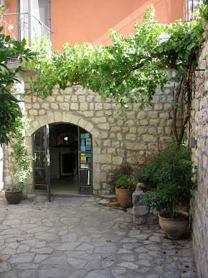
booked rooms at the gorgeous
Artists' Colony Inn in
Safed's Old City. The inn itself deserves a mention. Susan, the owner, was
very friendly. The inn is beautiful, uniquely designed with a perfect mix of
old and new. The Israeli breakfast was delicious and the views were amazing.
We will definitely be going back.
Safed is an ancient city located in northern Israel, 900 meters above sea level,
in the mountains of the Upper Galilee. It is one of Judaism's four Holy Cities,
along with Jerusalem, Hebron and Tiberias and today is considered to be the
centre of Jewish mysticism. According to the great mystics of the past, the
Messiah will come from Safed on his way to Jerusalem. The city has also become
known as Israel's art capital, though sadly many of the galleries seemed to be
closed when we visited, probably victims of Covid-19 and the lack of tourists in
the country.
According to some sources, the city was founded in 70CE. It flourished in the
16th century, when many famous Jewish religious scholars and mystics moved to
Safed following the
Spanish Expulsion, fleeing from the horrors of the
Inquisition. It
was here that the first printing press in the Middle East was set up, in 1578
publishing the first Hebrew book to be printed in Israel. At that time the town
was also a thriving trade centre. However, Safed suffered terribly during the
ensuing years due to earthquakes, plagues and Arab attacks. In modern times, the
liberation of Safed was one of the most dramatic episodes in the 1948 War of
Independence. We learnt all about it when we visited the Citadel or
Metzuda, located on a hilltop in the centre of the city.
The
Citadel is in fact the remains of what was in its day the largest Crusader
fortress in the Middle East. Throughout history, whoever controlled Safed's
citadel controlled the whole of the Galilee. It has been fought over by every
major power from the Romans onward, with the most recent battle being in 1948
during the War of Independence. The fledgling Jewish army captured the Citadel from the local Arab forces who took advantage of its towering location to bomb the Jewish Quarter down below. Today there are
two memorials at the Citadel, one listing the names of the 14
Palmach soldiers who fell in
the battle for the Citadel and a second spire monument, on the top of the hill, commemorating the 42 soldiers who fell in the battles over Safed.
We walked down the hill from the Citadel, towards the town. We spotted a
pillbox, above, jutting out into the
road and on the other side of the road, one of the buildings of Safed College.
During the
Mandate period these two buildings were part of the city jail and
police station compound. Before the British left the town they handed this
strategic location, along with three other high points in the city, to Arab forces. During the battle for Safed it was essential
that this extremely important site was captured and there was fierce fighting
over the location before victory went to the Palmach. You can still see bullet holes in the two buildings. Even though the old
pillbox has no practical use today it has been left as is due to its
historical status.
Opposite the pillbox is a Davidka monument. The Davidka was a homemade mortar
that was constructed in secret during the pre-independence period. It was very
inaccurate and its effectiveness was due more to the amount of noise it made, rather
than on the shell's ability to deliver a decisive blow! The mortar was crucial
in the battle of Safed and was used by Palmach and
Irgun soldiers in the battle
for the Citadel. Every year there is a memorial ceremony in front of the
Davidka, on
Yom HaZikaron (Remembrance Day), when the city honours its
dead, and a wreath is laid on the cannon itself.


We walked further along and found the Great Stairs. The stairs begin at the
bottom of the Old City and run right up to Safed's main shopping street near
the top of the city. We started at the top (very sensible!), stopping first
to look up and directly across the road where you can still see the
searchlight and the gun placement slits of the old watchtower built by the
British to guard the stairs, below.
The stairs were built by the
British to separate the Jewish and Arab quarters (now the Old City and the
Artists Quarter respectively) after
riots in 1936. They were heavily guarded and at night a searchlight swept the stairs to
make sure no one jumped from quarter to quarter.
During the period
leading up to and during the War of Independence, to cross from one side of
the stairs to the other was to take your life in your hands. It was so
dangerous that it became known as Stalingrad Alley, after the
Battle of Stalingrad.
The stairs are called, in Hebrew,
Ma'alot Olei Hagardom, in
memory of the members of the
Irgun (an underground Zionist
paramilitary group that operated in Mandate Palestine between 1931 and
1948) who were hung by the British in Acre and later buried in Safed
after the War of Independence.


We started to walk down these steep stairs, soon turning right. There
we found many of Safed's historic synagogues, including the Abhuav Synagogue
which has a Torah scroll from the Middle Ages. In the Yosef Caro Synagogue
you can see the famous
Shulhan Aruch (literally the "set table"), which dates back to the Middle Ages and
is still used as the primary source for understanding Jewish religious
laws. I simply enjoyed the narrow cobblestone lanes and alleys and the
doors and windows painted blue in mystical symbolism to confuse evil
spirits.


Back at the Great Stairs we turned left, which took us right back into the
Artists Quarter where we were staying. Before returning to the Artists' Colony Inn I set off to find the Ziffer Sculpture Garden, a small garden that was bequeathed to
the Safed municipality by the sculptor Moshe Ziffer and his wife Rachel. When I was an art student in Liverpool back in the late 1980s I had picked up a book of Ziffer's work (and found a note inside handwritten by the
sculptor!). I still have it on my bookshelves here in Israel. I was keen to see his
work for myself.
Moshe Ziffer was
one of Israel's premier sculptors. His work was exhibited in galleries in
Tel Aviv and Safed, as well as on the campuses of the Hebrew University in
Jerusalem, the Tel Aviv University, the Weizmann Institute of Science in Rehovot, New York and Brussels. He was an
environmental sculptor and worked in
stone. He sculpted several large sculptures, measuring over two metres high.
These sculptures are scattered around the garden for visitors viewing
pleasure though, despite the fact that Ziffer requested that the city care
for the premises and use the small house as a venue to assist new artists, I
found the garden terribly overgrown and in rather a mess. The sculptures
were still impressive.


