Showing posts with label Modi'in. Show all posts

Sunday, 29 March 2026

Hurvat Nekes

The war continues, and for the past month we have stayed mostly at home, or very close to it. Of course, daily life still goes on - we need to eat - and with Passover, the Festival of Unleavened Bread, beginning this week, there is even more food preparation than usual.
So we venture out from time to time, carefully planning each trip to the supermarket. We try to go shortly after a missile attack, reassured by the knowledge that there is a safe room at our destination. The sirens still sound, day and night. We are all exhausted, but for the most part, safe.
This blog post was written before the war began. I hope the day will come soon when we can once again visit Hurvat Nekes in peace.
Hurvat Nekes (חורבת נכס) is a beautiful site on the western outskirts of the city of Modi'in. ​Archaeological finds from many periods - from prehistoric times to the present day - have been discovered there, together with the standing remains of buildings from the former Arab village of al-Kunayyisa.
The name Hurvat Nekes translates as "the ruins of Nekes." Hurvat means "ruin" or "ruined site" in Hebrew ("khirba" in Arabic) and refers to a ruined site, abandoned village, or ancient archaeological mound, often containing remnants of buildings, cisterns, and walls. Hurvat is commonly used for smaller sites (villages, farms, outposts). Larger, mound-shaped sites are often called "tel" (תל) in Hebrew.
Hurvot, or "khirab", are common sites in the Eastern Mediterranean, often dating to the Byzantine or Roman period. They serve as crucial archaeological, agricultural, or residential markers.
Hurvat Nekes is made up of three low hills and the valleys separating them. From the western hill there are wide views toward the Shfela (lowlands) and the ruins of al-Kunayyisa and its orchards.​ Al-Kunayyisa was a former Arab village that was abandoned on 10th July 1948 during the War of Independence. The village lay less than 2 km to the northeast of the Ramle-Jerusalem highway, and was linked to it - and to neighbouring villages as well - by dirt paths.
Al-Kunayyisa, whose name likely refers to a small church or shrine (derived from the Arabic root kanisa, meaning "church"), was resettled in the early 20th century atop an earlier settlement, the remains of which include rough stone walls, arched doors and building foundations. Within the remains of the settlement, you can see the main alley, side alleys, residential buildings, courtyards and service buildings adjacent to them, including several tabuns and a granary. One of the buildings was probably used as a mosque, and a prayer niche (the mihrab) facing south can be seen.
Agriculture was the backbone of the villagers' economy, focusing mainly on the cultivation of grain. The villagers also cultivated citrus and olives in the northern and southern parts of the land, which they irrigated from nearby wells. Today, fig, almond, olive, carob, and pomegranate trees and cactuses grow among the buildings. The lands in the vicinity are cultivated by a nearby kibbutz.
A wealth of archaeological remains at Hurvat Nekes reflects continuous human activity in the area. As well as the remains of the village of Al-Kunayyisa, prehistoric flint tools, rock-cut water reservoirs and cisterns, stone cups, burial mounds, wine and olive presses, agricultural terraces and quarries have be found there. The finds represent several periods, including the Iron Age, the Roman period, the Byzantine period, the Mamluk period, and more.
The hills and slopes of Hurvat Nekes are dotted with low trees and shrubs, including buckthorn, Christ's thorn, and other native shrubs. At the time of our visit, on a beautiful sunny weekend at the end of January, almond trees were blossoming and the area was lit up with red anemones, or in Hebrew, "calaniot". The Hebrew name "calanit" comes from "kalanit" meaning "little bride", referring to the flower's delicate shape. It is Israel's national flower.
Today, the site of Hurvat Nekes functions as an open park that combines nature, history, mountain biking and hiking trails. A path crossing the centre of Hurvat Nekes forms part of the Israel Trail, Israel's national long-distance hiking route. Additional local marked trails (including green/yellow markings) connect the hills and valleys, though numerous pits and caves are scattered throughout the area, requiring hikers to proceed with caution. Cattle also graze in the area, and the slopes are home to a rich variety of wildlife, including yellow scorpions, beetles, centipedes, and other species.
From the western hill at Hurvat Nekes, the Modi'in-Jerusalem railway stretches out in the distance. At the top of the hill, we came across this charming little bench, below. The Hebrew sign reads: "In honour of the fighters. For everyone who sometimes needs a little peace and quiet."
Though I may not be a fighter in the traditional sense, that sentiment truly resonated with me. We enjoyed a well-earned rest, taking in the fabulous view.

Sunday, 5 May 2019

The Southern Hills

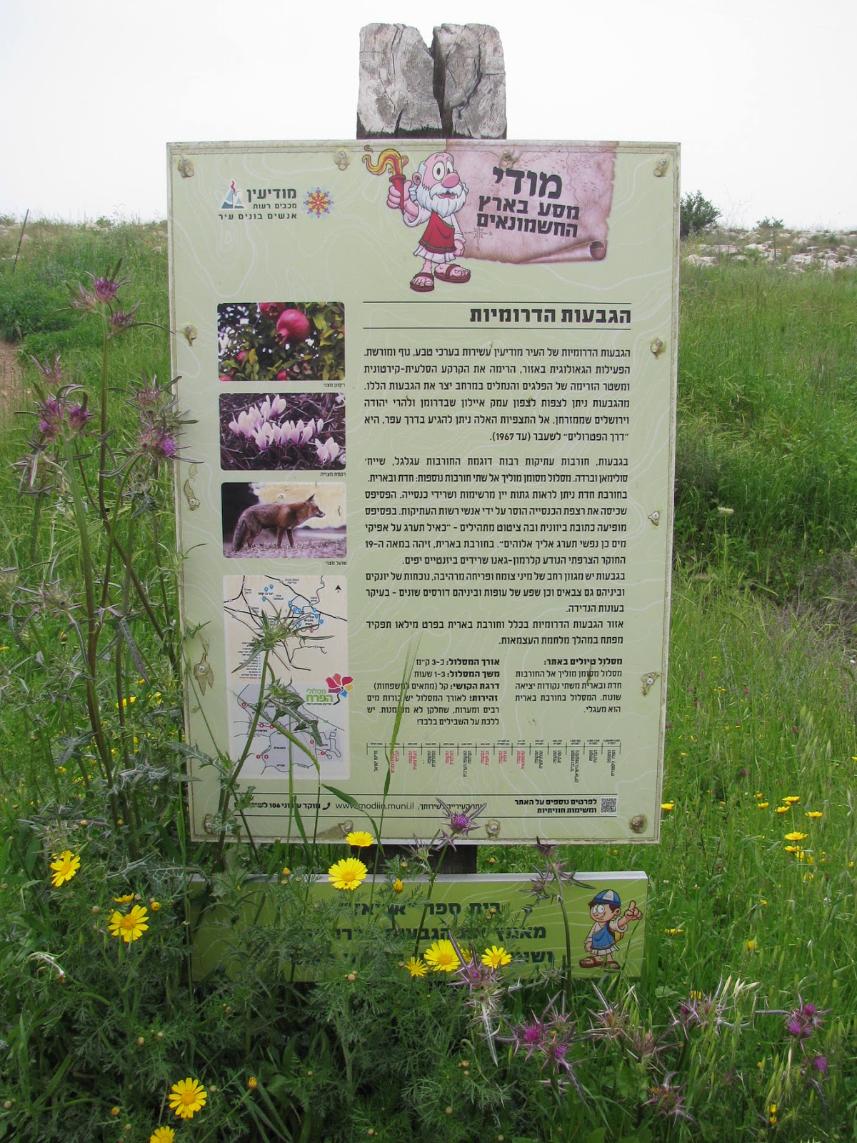
One recent weekend Mister Handmade in Israel and I decided to take a walk in the hills south of the Buchman neighbourhood of Modi'in. (Actually, I decided we were going out for a walk and he was, somewhat reluctantly, dragged along!). The hills contain ruins of ancient settlements and provide beautiful nature hikes in the winter and spring. The decent amount of rain that we have had this winter meant that the spring flowers were blooming in force and, thanks to an unusually large migration from Saudi Arabia and Kuwait this year, there were butterflies galore, crossing Israel on their way to Europe.
The southern hills run along the south of the city of Modi'in, 300 metres above sea level. The hills are part of the Mediterranean ecological corridor that connects the Ramot Menashe region with the Jerusalem Hills and the Judean Foothills. What makes this area special is the link between the humid Mediterranean region in Israel's north with the arid Mediterranean region in Israel's south. The corridor enables the passage of animals, plants and pollinating insects, thus playing a critical role in conserving the biological diversity.
The hills provide several breathtaking lookout points over the Ayalon Valley, Park Canada and the Jerusalem Hills. There are also many archaeological artifacts - wine presses, oil presses, ritual baths, cisterns, caves, terraces and agricultural facilities that are proof of extensive agricultural and human activity in ancient times.
In 2014, students of the Society for the Protection of Nature in Israel (SPNI) exploration clubs conducted a survey of cisterns on the southern hills. The survey mapped 18 ritual baths, caves, and cisterns.
The remains of the village of Hadat, with findings from the Chalcolithic period and throughout most periods of history up to the early Islamic period, are perched on the top of one hill. At its centre is a Byzantine church, including fragments of columns and a round apse on the eastern side of the church. On the slopes there are cisterns, burial caves and hewn wine presses. A mosaic floor with a verse from Psalms was exposed in the church, but the mosaic is covered today.
The French explorer and archaeologist Clermont-Ganneau visited here in 1874 and told of ancient stone carvings engraved with crosses. These ancient lintels, which Clermont-Ganneau dated to the Byzantine period, were lost over the years and were probably plundered by antiquities robbers.
Be'erit, named for the well located at the foot of the hill, was named after the Arabic place name Al-Bawira or Bawiri. The well is extremely deep and allowed water to be drawn from the groundwater level. This well is the only one known throughout all of Modi'in's hills, as opposed to the many cisterns throughout the region where rain water was collected. Today the walls of the well are covered with concrete, which indicates that the reinforcement was done within the last century, probably during the British Mandate Period.
The remains of the village of Kanubah, a small Arab village conquered during the War of Independence, indicate that it was once a Byzantine-era farm. There is a burial cave and not far from it are the remains of a large building, a courtyard and cisterns. A giant palm tree rises up besides the stones, a trough hewn out of stone and a water channel. On the rocks are small round niches or cupmarks which were used to make olive oil by crushing the olives in them. This work was reserved for the elderly and the infirm during the harvest period.
Hikers can also, if they are lucky, observe a variety of wild animals for whom the hills serve as a habitat. Mountain gazelles, hyenas, jackals, porcupines, foxes, mongooses, badgers and various rodents live on the hills. Reptiles observed include fan-fingered geckos, stellagamas, Greek tortoises and Günther's cylindrical skinks (the last two being endangered species). A variety of birds of prey, as well as migratory birds such as storks and pelicans, and a host of songbirds can also be spotted.
As I previously mentioned, when we visited there was an influx of the painted lady, or Vannesa Cardui, species of butterfly, a type of migratory butterfly that travels in groups for distances of thousands of kilometres in the search for food. The large amounts of rain that fell in January and February not only in Israel but also in the Arabian Peninsula, turned the desert turned into fertile land. With their food sources drying up in the Arabian desert, the large numbers of butterflies migrated in search of food. The butterflies continue northward, crossing Cyprus and on to southern Europe to create their next generation.
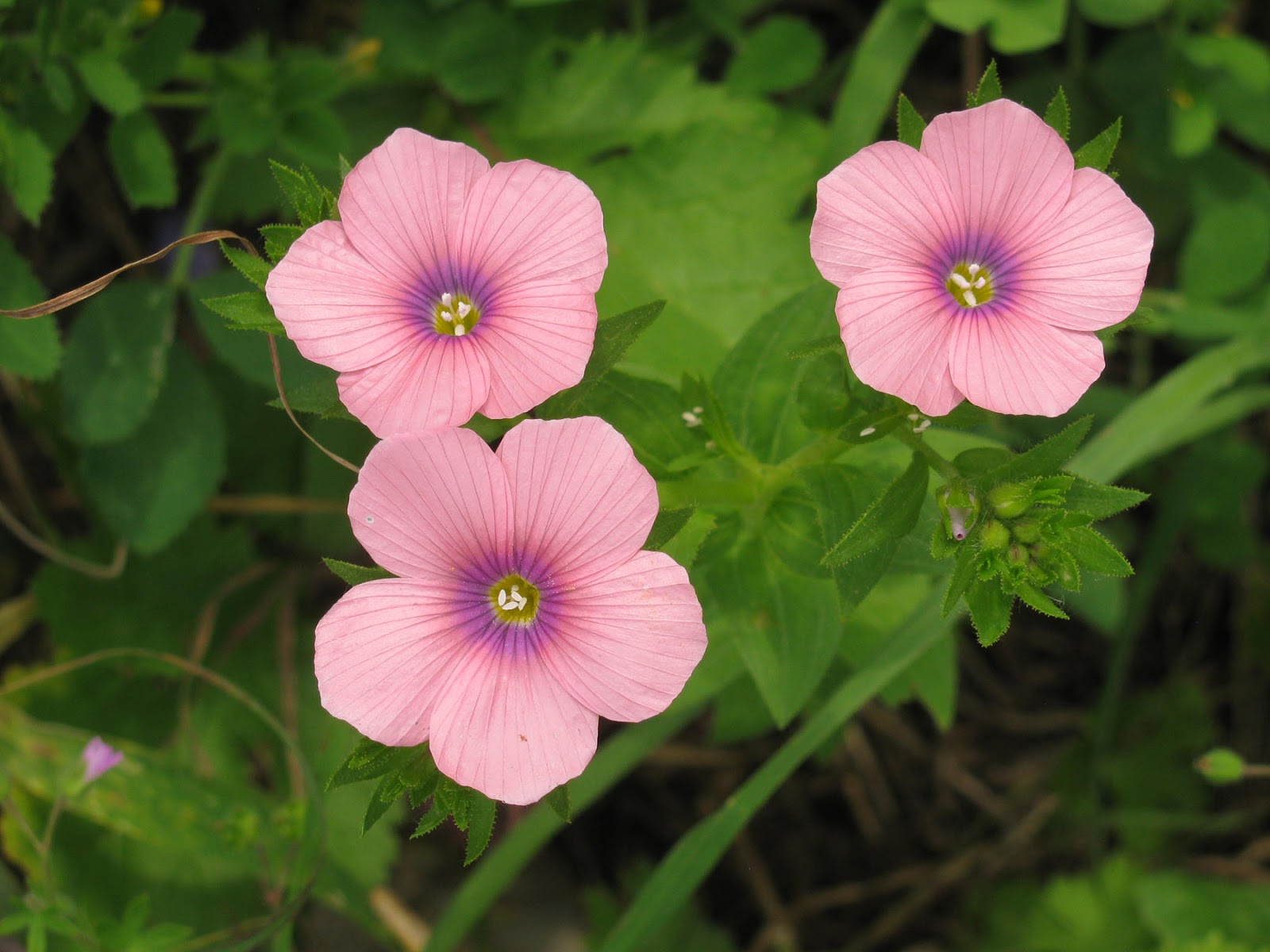
There are hundreds of species of plant life on the southern hills. In January and February the almond tree blossoms in the orchards of Be'erit and Kanubah, and red anemones can be seen in the valley between Hadat and Be'erit. In the winter and spring the undergrowth is in full bloom with pink cyclamen, winter crocus, Tuberous Hawkbit, Asphodelus ramosus, Syrian Iris and more. At the start of spring the Persian buttercup, cornflower, hairy pink flax, garland chrysanthemum, Jerusalem sage and purple clover bloom. In August and September, Sea Squill blossoms along the route.
Trees that can be found on the hill include carob and birch, alongside a range of orchard trees and large pine trees. The pine trees are estimated to be some 130 years old!
In addition to the area's landscape qualities and its importance in providing open spaces for Modi'in residents, this area, as mentioned above, is of critical importance on a national scale. The sequence of natural open spaces allows for biological diversity and the passage of wildlife between various habitats. In Modi'in's current master plan the southern hills are zoned as land for construction, but due to pressure exerted by the SPNI and local residents, and thanks to demonstrations in support of conserving the hills, there is now hope that the decision makers will rethink the future of the hills.