Showing posts with label military history. Show all posts

Thursday, 27 January 2022

Mrar Hills National Park

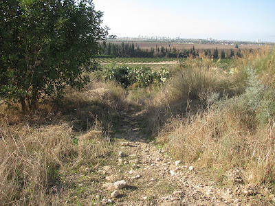
The Mrar Hills are situated in the Shfela (Judaean foothills), south of the city of Rehovot and north of Gedera. The hills are the fourth and last ridge among the kurkar (calcareous sandstone) ridges on the southern coastal plain. Open kurkar areas in Israel are in decline and their rich world of flora and fauna, some of which are unique to them, are disappearing. Part of the kurkar ridge in the southern part of the Mrar Hills has been declared a national park and is maintained by the Nature and Parks Authority. 
The Mrar hills rise 94 meters above sea level. In the Book of Joshua they are defined as a mountain, "Mount Baalah", on the border of the lands of Dan and Judah. Potsherds from the Chalcolithic period and burial caves from the Middle Bronze Age and the Roman and Byzantine periods, above, have been found in the hills, showing that people have lived in Mrar for many generations. 
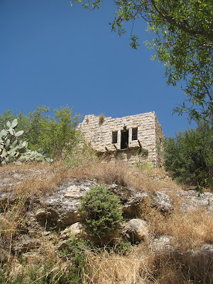
Some of the caves may have been turned into dwellings or storerooms during the Ottoman period, when there was a Muslim cave village here. The name Mrar ("caves" in Arabic) shows us the importance of caves to the village.
At the end of the Ottoman period - and to this day - orchards were planted in the fertile soil that collected in the valleys between the kurkar ridges. The inhabitants of Mrar Hills had a few water sources, the most important and dependable of which was the Sorek Stream, which flows from the south. During the Ottoman period the village had a well and a cistern. The village also had a controlling view of its surroundings, which gave it a strategic advantage, an important element in pre-modern times for the development of a settlement. On the west was the ancient international road connecting Egypt and Syria (the "Via Maris" or "Way of the Sea"). Another road linked the settlements that developed to the east. In certain periods an east-west road passed south of the village, connecting the coastal plain with the Judaean lowlands and the Jerusalem Mountains.
At the top of the hill are water storage pools built by the Mekorot company as part of the Yarkon-Negev water line that was established between 1952 and 1955, before construction of the National Water Carrier. Their purpose was to channel water from the Yarkon Springs to agricultural communities in the northern Negev.
A statue of a horseman stands nearby as a reminder of the many battles that have taken place in these hills, before the establishment of the State of Israel. On 13th November 1917, as part of the battles of the First World War in Israel, the Battle of the Mrar Hills took place on the ridge. British forces launched a combined assault, when English cavalry (Yeomanry) and Scottish infantry fought against 3,000 Ottoman troops and defeated them. The British forces on their way to Ramle encountered the Ottoman forces occupying positions in the ridge and nearby villages. At the end of the battle, the British took control of the main railway junction, with railway lines leading to the south of Israel, and opened the way to the Jerusalem-Jaffa road. The retreating Ottoman forces lost hundreds of troops and about a thousand were captured by the British. The British lost about 500 soldiers.
The Yeomanry charge at these hills, known as El Mughar Ridge, is considered one of the last cavalry charges in military history.
The agave shrub can be found in several locations on the hills, above. Agave grows for about 10 years before it blooms, which it only does once in its lifetime. Before the agave blooms, it produces a long, thick trunk from which a cluster of thousands of fragrant yellow flowers emerges, which are pollinated by birds. Arabs customarily plant the agave in cemeteries. Agave was once grown in Israel to produce fibre and medication, but today it is used for ornamental purposes only. Other species of agave elsewhere in the world are cultivated to make sugar and tequila.
On the southeastern fringe of the ridge lay an Arab village called Al-Ma'ar ("The caves"), from which the name of the hills full of kurkar caves was derived. With the construction of RAF Aqir, which served as the main Royal Air Force station in Palestine during the Second World War, the importance of the village increased. At the beginning of the War of Independence, in May 1948, the village was captured by the IDF. After the war, the newly named Tel Nof Airbase became a central base for training the Paratroopers Brigade. A monument to the fallen paratroopers in Israel's wars, which we saw at the start of our visit, is located at Tel Nof, near a site that was once a major paratroopers base.
In 2020, the The Mrar Hills National Park was upgraded. Stairs were built, paths were paved and signs were set up explaining the landscape, the vegetation and the battle of the cavalry that took place there. The metal horseman found his place high up on the ridge.
From the top of the hill there is a spectacular view of the surrounding settlements: to the southwest you can see Gedera, to the southeast is Moshav Beit Elazari, established in 1948 by Jewish immigrants from eastern Europe. You can also see the runway and hangars of the Tel Nof Air Force Base.
Before returning to our car parked at the paratroopers monument, we stopped for a rest on the grass in front of the monument, above. The towering pillar of the monument, with parachute wings, is carved with the words of the poet and Special Operations Executive, Hannah Szenes, "A voice called to me - and I went, I went because the voice called." The monument's long stone wall is inscribed with the biblical verse: "They were swifter than eagles, they were stronger than lions." (2 Samuel 1:23). On the wall the names of the paratroopers who fell from 1949 onward. The monument was built at the initiative of the paratroopers force and the bereaved families. It was unveiled on 29th October 1960.

PoCoLo

Monday, 16 August 2021

Safed (or Zefat, Tsfat, Zfat, Safad, Safet, Tzfat)

After our visit to the Hula Nature Reserve and Rosh Pina, we drove on to the city of Safed, where we were staying for the weekend. I hadn't been there since 2010 so was excited to go back and have another look around. Our friends had booked rooms at the gorgeous Artists' Colony Inn in Safed's Old City. The inn itself deserves a mention. Susan, the owner, was very friendly. The inn is beautiful, uniquely designed with a perfect mix of old and new. The Israeli breakfast was delicious and the views were amazing. We will definitely be going back.
Safed is an ancient city located in northern Israel, 900 meters above sea level, in the mountains of the Upper Galilee. It is one of Judaism's four Holy Cities, along with Jerusalem, Hebron and Tiberias and today is considered to be the centre of Jewish mysticism. According to the great mystics of the past, the Messiah will come from Safed on his way to Jerusalem. The city has also become known as Israel's art capital, though sadly many of the galleries seemed to be closed when we visited, probably victims of Covid-19 and the lack of tourists in the country.
According to some sources, the city was founded in 70CE. It flourished in the 16th century, when many famous Jewish religious scholars and mystics moved to Safed following the Spanish Expulsion, fleeing from the horrors of the Inquisition. It was here that the first printing press in the Middle East was set up, in 1578 publishing the first Hebrew book to be printed in Israel. At that time the town was also a thriving trade centre. However, Safed suffered terribly during the ensuing years due to earthquakes, plagues and Arab attacks. In modern times, the liberation of Safed was one of the most dramatic episodes in the 1948 War of Independence. We learnt all about it when we visited the Citadel or Metzuda, located on a hilltop in the centre of the city.
The Citadel is in fact the remains of what was in its day the largest Crusader fortress in the Middle East. Throughout history, whoever controlled Safed's citadel controlled the whole of the Galilee. It has been fought over by every major power from the Romans onward, with the most recent battle being in 1948 during the War of Independence. The fledgling Jewish army captured the Citadel from the local Arab forces who took advantage of its towering location to bomb the Jewish Quarter down below. Today there are two memorials at the Citadel, one listing the names of the 14 Palmach soldiers who fell in the battle for the Citadel and a second spire monument, on the top of the hill, commemorating the 42 soldiers who fell in the battles over Safed.
We walked down the hill from the Citadel, towards the town. We spotted a pillbox, above, jutting out into the road and on the other side of the road, one of the buildings of Safed College. During the Mandate period these two buildings were part of the city jail and police station compound. Before the British left the town they handed this strategic location, along with three other high points in the city, to Arab forces. During the battle for Safed it was essential that this extremely important site was captured and there was fierce fighting over the location before victory went to the Palmach. You can still see bullet holes in the two buildings. Even though the old pillbox has no practical use today it has been left as is due to its historical status.
Opposite the pillbox is a Davidka monument. The Davidka was a homemade mortar that was constructed in secret during the pre-independence period. It was very inaccurate and its effectiveness was due more to the amount of noise it made, rather than on the shell's ability to deliver a decisive blow! The mortar was crucial in the battle of Safed and was used by Palmach and Irgun soldiers in the battle for the Citadel. Every year there is a memorial ceremony in front of the Davidka, on Yom HaZikaron (Remembrance Day), when the city honours its dead, and a wreath is laid on the cannon itself.
We walked further along and found the Great Stairs. The stairs begin at the bottom of the Old City and run right up to Safed's main shopping street near the top of the city. We started at the top (very sensible!), stopping first to look up and directly across the road where you can still see the searchlight and the gun placement slits of the old watchtower built by the British to guard the stairs, below.
The stairs were built by the British to separate the Jewish and Arab quarters (now the Old City and the Artists Quarter respectively) after riots in 1936. They were heavily guarded and at night a searchlight swept the stairs to make sure no one jumped from quarter to quarter.
During the period leading up to and during the War of Independence, to cross from one side of the stairs to the other was to take your life in your hands. It was so dangerous that it became known as Stalingrad Alley, after the Battle of Stalingrad.
The stairs are called, in Hebrew, Ma'alot Olei Hagardom, in memory of the members of the Irgun (an underground Zionist paramilitary group that operated in Mandate Palestine between 1931 and 1948) who were hung by the British in Acre and later buried in Safed after the War of Independence.
We started to walk down these steep stairs, soon turning right. There we found many of Safed's historic synagogues, including the Abhuav Synagogue which has a Torah scroll from the Middle Ages. In the Yosef Caro Synagogue you can see the famous Shulhan Aruch (literally the "set table"), which dates back to the Middle Ages and is still used as the primary source for understanding Jewish religious laws. I simply enjoyed the narrow cobblestone lanes and alleys and the doors and windows painted blue in mystical symbolism to confuse evil spirits.
Back at the Great Stairs we turned left, which took us right back into the Artists Quarter where we were staying. Before returning to the Artists' Colony Inn I set off to find the Ziffer Sculpture Garden, a small garden that was bequeathed to the Safed municipality by the sculptor Moshe Ziffer and his wife Rachel. When I was an art student in Liverpool back in the late 1980s I had picked up a book of Ziffer's work (and found a note inside handwritten by the sculptor!). I still have it on my bookshelves here in Israel. I was keen to see his work for myself.
Moshe Ziffer was one of Israel's premier sculptors. His work was exhibited in galleries in Tel Aviv and Safed, as well as on the campuses of the Hebrew University in Jerusalem, the Tel Aviv University, the Weizmann Institute of Science in Rehovot, New York and Brussels. He was an environmental sculptor and worked in stone. He sculpted several large sculptures, measuring over two metres high. These sculptures are scattered around the garden for visitors viewing pleasure though, despite the fact that Ziffer requested that the city care for the premises and use the small house as a venue to assist new artists, I found the garden terribly overgrown and in rather a mess. The sculptures were still impressive.
Photo credit: The Artists Colony Inn

Monday, 19 July 2021

Lifta

Lifta was an Arab village on the outskirts of Jerusalem. In 1948, during Israel's War of Independence, it was abandoned and its inhabitants fled to East Jerusalem and the West Bank. In the 1950s Jewish families, who were new immigrants from Yemen and Kurdistan, were resettled in the village. These families were evacuated by the State of Israel in 2017 and were the last inhabitants of Lifta. In the 1980s Lifta was declared a municipal nature reserve. The numerous original dwellings, spring and agricultural terraces scattered across the steeply sloping site now serve as a reminder of an architectural and agricultural culture that was prevalent in the Middle East for thousands of years.
The abandoned Arab village has been identified with the biblical Mei Neftoach. Mei Neftoach is mentioned in the Bible as the border between the Israelite tribes of Judah and Benjamin. The spring is mentioned in the Book of Joshua as delineating the northern border of the tribe of Judah: "The outcome of the lottery for the tribe of the Children of Judah.... The border proceeded directly from the top of the mountain to the spring of Mei Neftoach and broadened to the cities of Mount Ephron." (Joshua 15:9).
Ruins have been found at Lifta dating back to the First Temple period (1006-506 BCE). It was inhabited in the Roman, Byzantine and Crusader periods. The remains of a courtyard home from the Crusader period can still be seen in the centre of the village, though the extensive remains visible today mostly date from the late Ottoman era. They include several olive oil presses, flour mills, a mosque and maqām (Islamic shrine).
Common Caper, צלף קוצני
In 1917 Lifta surrendered to British forces, who ruled over the land from 1917 until May 1948. The population remained all Muslim, though some villagers sold land to Jews that became the neighbourhood of Romema. During the 1929 Palestine riots inhabitants of the village actively participated in the robberies and attacks on nearby Jewish communities.
Following the United Nations' 29th November 1947 vote to partition Palestine, the village served as a base from which attacks were launched against the Tel Aviv-Jerusalem highway and Jewish neighbourhoods. The Irgun and Lehi carried out reprisal raids on a cafe in Lifta and along the fringes of the village and by early February its inhabitants had fled. However, the deserted houses of  the village were left untouched, perhaps because of the difficulty of clearing the hillside and its location near the 1949 armistice line (the Green Line).
Following the war, the Jewish Agency and the State of Israel settled Jewish immigrants from Yemen and Kurdistan in the village. Ownership of the houses was not registered in their name. Living conditions in Lifta were difficult due to the buildings that were in poor repair, poor roads and transport, and lack of electricity, water and sanitation infrastructure. By 1969-71 most of the Jewish inhabitants of Lifta chose to leave and, over time, drug addicts moved into the abandoned buildings, which were then deliberately vandalised by the Israel Police to discourage squatters. Holes were drilled in the roofs of the evacuated buildings to make them less habitable. Only 13 families, who lived in the portion of the village close to Highway 1 and who didn't suffer from transportation issues, chose to remain.
Some of the buildings in the village were later used as a drug abuse rehabilitation centre, a high school and an open education school. In the 1980s Lifta was declared a nature reserve under the auspices of the Israel Nature and Parks Authority. 
In 2004 plans were announced to build new housing and renovate the old stone buildings into luxury villas. Former residents and archaeologists brought a legal petition to preserve the village as a historic site. In 2012 the plans were rejected by the Jerusalem District Court. Meanwhile, some of the Jewish residents of Lifta, who were settled there by the Jewish Agency in the 1950s but never received property rights, were ordered expelled without compensation to facilitate the widening of Highway 1. After a long campaign against the eviction, they were able to prove that they were not squatters and that the state had been remiss by not offering Lifta's Jewish families an opportunity to purchase their homes.
By 2017 the last Jewish residents had left the village. In 2020 a boutique hotel opened there in a newly restored centuries-old building. The spring in the centre of the ruined village has been landscaped as a popular swimming hole turned mikveh and the area has become a natural and rich habitat for many plants and animals, some protected and endangered. 55 out of the 450 pre-1948 stone houses are still standing.
Lifta remains the last remaining Arab village in Israel that was abandoned in 1948 to have not been either completely destroyed or re-inhabited. It has been referred to as the "Palestinian Pompeii". Due to its uniqueness and importance, in 2015 it was added to Israel's tentative list of sites to be considered for UNESCO's World Heritage List. It survives as a rare place of heritage, recreation and memory for those who wish to visit it.
As an interesting aside, when Lifta was an Arab village it was among the wealthiest communities in the Jerusalem area, and the women were known for their fine embroidery. Thob Ghabani bridal dresses were sewn in Lifta. They were made of ghabani, a natural cotton covered with gold colour silk floral embroidery produced in Aleppo. The sleeves were tapered and the sides, sleeves and chest panel of the dress were adorned with silk insets. The dresses were ordered by brides in Bethlehem. The married women of Lifta wore a distinctive conical shaṭweh headdress, that was also worn in Bethlehem, Ayn Karim, Beit Jala and Beit Sahour.