Nahal Sorek is a deep valley that begins close to Ramalla and winds its way through the Judean Hills and the Shfela (lowlands) to the coastal plain. In ancient times it was a thoroughfare to Jerusalem and there were agricultural settlements along its path. The name sorek comes from the root שרק, "red grapes" and refers to the vines that grew along the valley. Over the years this area was known for its grapes and today there are a number of fine boutique wineries in the district.
Nahal Sorek was the place where Delilah lived, and Samson came to meet her for the first time. It was also the place she enticed him to tell her the secret of his strength, and where he was eventually captured by the Philistines:And Samson went to Gaza… And it came to pass afterward, that he loved a woman in the brook/valley of Sorek, whose name was Delilah. And the lords of the Philistines came up to her, and said to her: "Entice him, and see wherein his great strength lies, and by what means we may prevail against him, that we may bind him to afflict him…"
- Judges Chapter 16:4
Nahal Sorek is known in Arabic as Wadi es-Sarār.
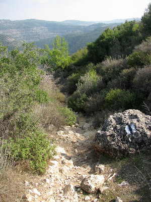
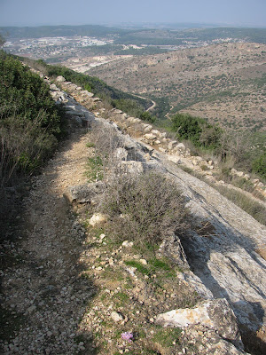
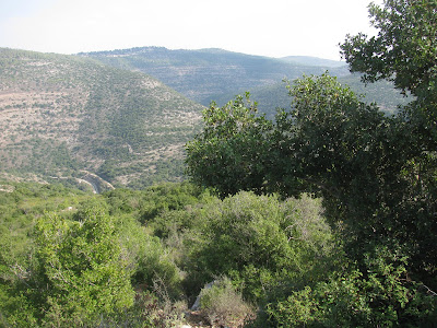
We started our hike on a blue-marked jeep trail from which there were amazing views of the Sorek Valley, soon turning onto a black-marked footpath which runs alongside the valley. Climbing ever downwards the landscape around us began to change. From a rocky footpath and gorgeous views of the valley, we entered a wooded area with many Katlav trees. Katlav is the Hebrew name of a striking, red-barked evergreen tree native to the Mediterranean region, also known as the Greek Strawberry tree or Arbutus Andrachne. The bark is smooth and sheds during the summer, leaving a pistachio green colour, which changes gradually to a beautiful orange brown. The small red berries of the Katlav tree apparently taste like tart strawberries and ripen in November, though I was too scared to try them.
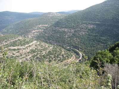
Walking along the black-marked footpath we had a continuous view of the old Tel Aviv-Jerusalem railway which runs through this valley, above. In the 19th century, Nahal Sorek served as an important connection between the two major cities in the area, Jaffa and Jerusalem. Because railways at the time were reliant on water sources, several surveyors who planned the first railway in the Middle East, the Jaffa–Jerusalem line, decided to use Nahal Sorek as the main route for the line. It was inaugurated under Ottoman rule in 1892 and connects Tel Aviv with the Jerusalem Malha station via Beit Shemesh. The scenic winding ride takes 1 hour 40 minutes.A new high-speed railway line connecting Tel Aviv and Jerusalem avoids Nahal Sorek and its curves, instead using bridges and tunnels to bypass the hills and valleys, but the older railway along Nahal Sorek has been refurbished and remains in use. There used to be an ancient road here, but it was dug up when the railway was established.
We finally spotted Tur Shimon or Horvat Tura, in the distance, below. These are the ruins of a royal fortress from the Hasmonean period. The Arabic names of the site - Khirbet Sammunieh and Khirbet Tantura - preserve the ancient name of the fortress "Tur Shimon", or the Mountain of Shimon. The fortress may have been built by Shimon, the son of the Hasmonean ruler Matityahu, or by Shimon's son, in memory of his father. Naming fortresses after other rulers, family or friends was common in the Hellenistic and Roman world. In maps of the British Mandate period the ruin is also named Khirbet et-Tantura ("Ruin of the Point"), so-called after the shape of the hill.A trough beneath Tur Shimon
Tur Shimon, which rises 595 metres (1,952 ft) above sea level, has not been excavated. Mister Handmade in Israel and I got halfway up but struggled without a pathway. The hill is covered with brushwood and wild growth, ashlars and partially standing walls of stones. The grounds are apparently strewn with fragments of ancient pottery from the Hellenistic period, the early Roman period, the Iron Age and from the Byzantine era. I'll try again another time!
Returning to the blue trail, it was a steep climb up the side of the valley and there was some rock climbing required. After about 45 minutes we reached the top where a jeep trail on the top of the ridge returned us to our starting point. We had enjoyed wonderful views of the surrounding hills, including a glimpse of Jerusalem and of the zawiya (an Islamic religious school or monastery) at Dayr al-Shaykh, above, a Palestinian Arab village which was deserted during the 1948 War of Independence. It had been an exhausting but wonderful hike!
* This post has been shared on Nature Notes, The Good. The Random. The Fun., Wordless Wednesday (on Tuesday), Our World Tuesday, Pictorial Tuesday, Tuesday's Treasures, Travel Tuesday and My Corner of the World.










23 comments:
This is so fascinating! I've never been to Israel, but through your descriptions of the area, I can totally feel its atmosphere. It really does sound like a hard hike, but I'm so glad you did it! #MMBC
Whoa, such a gorgeous place to hike!
Looks like a hard hike but the flowers you found where like hidden little gifts to encourage you. Another great post! #MMBC
That does sound like a hard hike but well worth the effort with all the sights you saw.
That does look like it would be a challenging hike. After my all-too-brief visit to Israel it changed the way I think of those in the Bible stories. The terrain and the heat demanded strength and stamina for those who traveled on foot.
Thank you for sharing at https://image-in-ing.blogspot.com/2021/02/cedar-creek-galleries-not-your-average.html
What a beautiful place for a hike (although it does sound like it was a tough one) - the views over the valley are beautiful and it was so interesting to read more about the history of the area too. #MMBC
REally lovely photos! It must have been rewarding to have made this hike! Have a wonderful week!
With such stunning views and beautiful flowers, your hike looked well worth the effort. It looks like a hot day so it can't have been easy. The Biblical references were interesting and I look forward to seeing those pottery shards if you go again. xx
What amazing views!!
I love the beautiful wild flowers.
Worth a Thousand Words
Nice place to hike. The blooms are so lovely.
How nice to be out and about! Finally! And the weather has been so lovely.
Amalia
xo
Wow, such a beautiful hike! I love all the wildflowers and all the biblical and historical points you shared as well. Good job that you could do such a challenging hike !! Thank you for sharing!♡
...the green and colorful flowers are welcomed sights in this roughed landscape. Thanks for sharing, take care and stay safe.
I enjoyed coming along with you. Lots of biblical and historical references as well as beautiful photos.
Beautiful photos, and to hike where the footprints of Jesus may have been is so awesome. Happy Tuesday
What wonderful hikes you take.....
What a great hike with wonderful views.
what a great walk, beautiful landscape, beautiful flowers and interesting history!
You are so lucky to live in such a beautiful country. It does look very dry and dusty compared to our lush landscape...but there is so much of it, and so much beauty to be found. I love how you seek out those gorgeous little flowers. I think I would have enjoyed the railway trip more than the hike though.
#mmbc
Saffron meadows, how beautiful. It is interesting to put pictures to what I only knew through Biblical references before, thank you.
Wow, the views sure worth your time and effort! Thanks for sharing these lovely vistas with us. The flowers you found are so pretty, too.
It's great to see your link at 'My Corner of the World' this week!
Beautiful country!
Post a Comment