My first pick, the Aircraft Trail around Mount Eitanim, encircles the summit of Dayr 'Amr and the site of the Eitanim Mental Health Centre. Dayr 'Amr was a tiny Arab village where a handful of people lived until Israel's War of Independence. It was named after a local sage known as Amr the Messenger, al-Sa'i 'Amr, the messenger of Umar Ibn al-Khattab, who conquered Jerusalem in the 7th century CE. Local tradition links the village to Sheikh Hussein, who was also known as Abu al-Armala ("father of the widow") as he was a renowned patron of widows and orphans. In 1940 the Arab Higher Committee initiated the establishment, at the top of Mount Eitanim, of an educational institution where students - most of whom were orphans whose fathers had been killed in the Arab Revolt of 1936-1939 - could combine study with farming. Slightly later on work was also begun on a school for girls. In 1950 the buildings of the boys' farm were transformed into a hospital for people with tuberculosis, becoming a Mental Health Centre in 1952. The Bezeq telephone and television company has also established a large facility, with radar equipment, near to the summit of the hill.
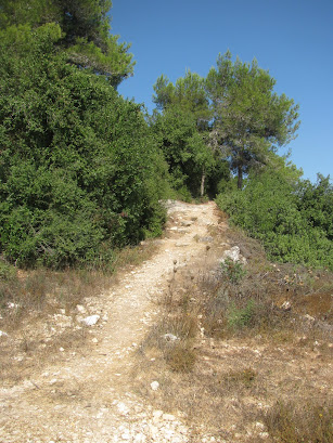
Mount Eitanim towers 776 metres above sea level and, after just a couple of minutes walking the trail, the magnificent landscape of the Jerusalem Hills came into view. Terraced slopes, cisterns and the remains of small buildings from the village of Dayr 'Amr were all visible below the trail. Large cypress and carob trees grow among the houses.
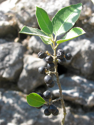
We turned left on to a stepped trail that climbs slightly, passing an assortment of native woodland trees including Israeli oak (Quercus calliprinos), Palestine pistachio (Pistacia palaestina, also known as Terebinth) and a large numbers of Greek strawberry trees (Arbutus andrachne). We stopped for breakfast at a large terrace which looked different to the other terraces we had already passed along the way. It is thought to have been built in the 1950s by new immigrants employed in work on national projects.
Amid the turmoil of battle there was no time to look for the remains of the plane. The principal of the orphanage at Dayr 'Amr, Ahmad Sameh Al-Khalidi, had been too ill to flee together with the other residents of the village and farm. He led an intelligence officer of the Harel Brigade's 6th Battalion to the spot where the plane had crashed but the bodies were not found until some time later. Following instructions from members of a Khirbat al-Jab'a family (Moshav Givat Yearim now occupies the site of this vanished village), the officer arrived at a cave where the remains of the plane's crew had been placed. They were removed and taken for burial at Kibbutz Kiryat Anavim. Today the cave no longer exists. Part of the plane's engine was found and laid at the main Air Force memorial site on Har HaTayyasim ("Pilots' Hill"), our next port of call. Another section of it was placed in the garden at Moshav Givat Yearim.


Har HaTayyasim is carefully maintained and is a lovely area to explore. From a gorgeous lookout point the panoramic views of the surrounding countryside and mountain ranges were spectacular. (See photos below) The top of this mountain is actually part of a 450 dunam nature reserve. In the spring 10 different species of orchid can be spotted. A hiking trail passing ancient agricultural terraces leads from the monument to Ein Tayyasim (Pilots' Spring) but it includes a steep climb and Mister Handmade in Israel and I were done for the day. It's always good to have a reason to go back!
* The northern section of the Judaean Hills is referred to as the Jerusalem Hills, and the southern one as the Hebron Hills.
**This post has been shared on The Good. The Random. The Fun., Wordless Wednesday (on Tuesday), Sharon's Souvenirs, Tuesday's Treasures, Our World Tuesday, Pictorial Tuesday, My Corner of the World and All Seasons.


19 comments:
Hello,
Thanks for sharing.
I really love the butterfly!
Thanks for taking me on a wonderful walk through the hills. Another enjoyable excursion. #MMBC
What a wonderful walk you had. The views really do look amazing! x
Gorgeous views!
What a beautiful butterfly! I've never seen one like that here - it's gorgeous!
Thanks for sharing at https://image-in-ing.blogspot.com/2020/10/the-fungus-is-among-us-mushrooms.html
Those are some really lovely views! #MMBC
The views are amazing. A reminder that every landscape is steeped in history. #mmbc
...escaping to nature has always been important, but more so with Covid-19. Thanks for stopping by and take care!
Good one!!!
What a lovely walk and the scenery looks spectacular. Good to hear all the bits of history too. The butterfly is beautiful. I'm hopeless at taking photos of wildlife; they're usually blurry as I get too excited and jerk the camera. :O) xx
Looks like beautiful scenery. Happy Wednesday.
In the beginning of the pandemic we searched for walking trails, but in the end we found we were more diligent about walking for exercise if we used the neighbourhood sidewalks where we could maintain social distance. - Margy
You certainly found some interesting sights on your walk! Thanks for sharing your photos as well as the history.
Your link at 'My Corner of the World' this week is greatly appreciated!!
It’s great to find a cooler temperature place to hike in the summer. And especially ones with those beautiful views and of historical significance . Not such ancient history this time, for me anyway, since most of what you shared happened in my lifetime....(which no doubt seems ancient to many people actually!)).... I’m happy to know these trails and terraces are carefully maintained. .... .
Really beautiful photos! I especially liked the one of the butterfly.
Wishing you a grand weekend!
Love reading about all the history behind a place on your posts.
What a great time you spent her at this National Park. Am prejudiced, because ever summer for about 18 years we spent a summer week at a national park (in California), Many thanks for all the history you provided with it too, Lisa! So you have lockdowns too, eh? The is the first time I'm reading about it in your country.A great thanks from All Season for the time you spent to create this post! You're the best! Jesh
Thanks for your continuing history of various areas of Israel. The park looks quite beautiful. The tragedies of war seem intertwined with many of these locations.
I am just in awe of the beauty in your backyard! What a great way to spend these days, social distancing in the best possible way :)
Post a Comment