

Special sites in the forest include the Wildflower Trail, remains of ancient settlement and Izbet Sartah, which has been identified as the Biblical site of Even HaEzer. In the spring and autumn these points are excellent locations for observing migratory birds, whose flight path passes just overhead, and for seeing gorgeous wildflowers in bloom.


One section of the forest, in the east, is intended for walkers and cyclists only, and vehicles are forbidden there. We arrived on the marked road and then proceeded on foot on the red-marked "Wildflower Trail". This is a kilometre long circular trail, climbing up the hill to a small viewing point, before taking us back down to our starting point.


From the Dayar Ruins we descended the marked path and joined up once again with the "Wildflower Trail". The path took us down the hill, walking on natural stone steps, until we reached our starting point once more.
Our next port of call was Even HaEzer Hill, below. This site is located in the western part of the Rosh HaAyin forest. We parked the car once again and entered the forest on foot. The Even HaEzer path began just near the road and took us all the way to the archaeological site. The path is indicated by posts marked in black. In the spring you can see narcissus, cyclamen, anemone and asphodel in the area.


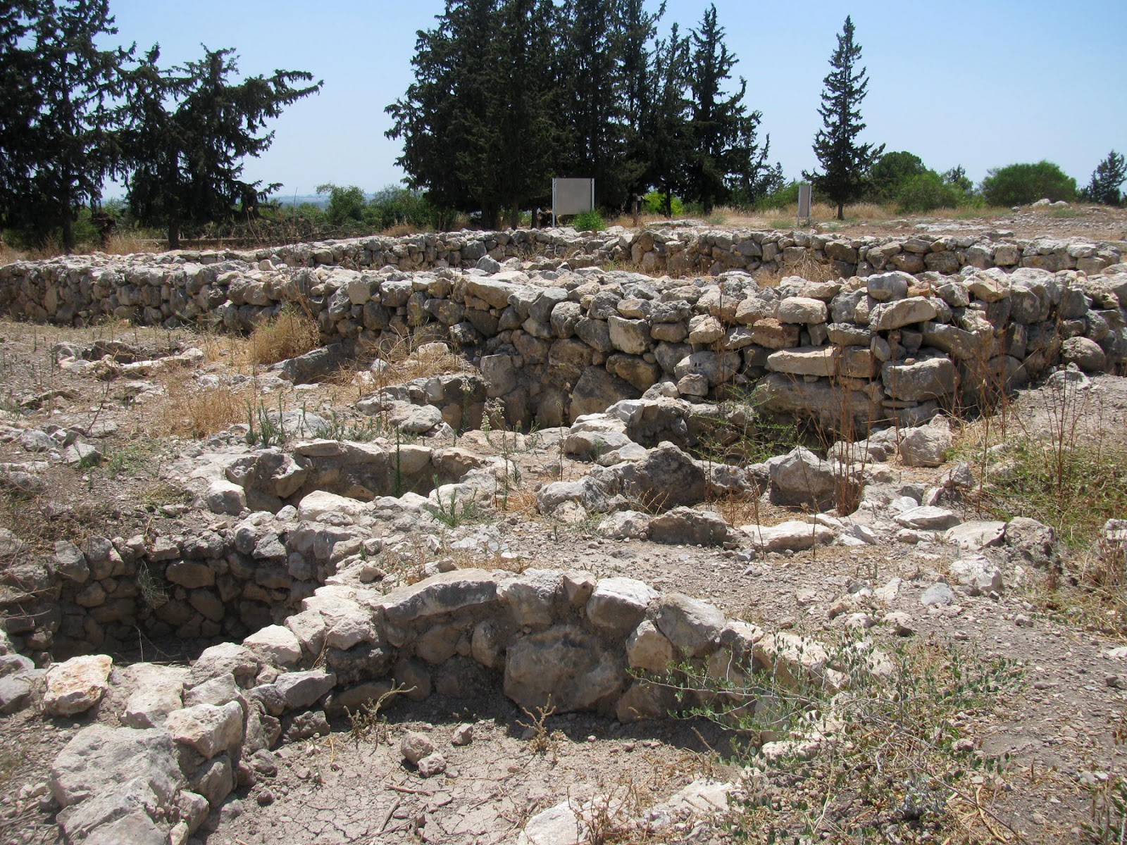
We passed by the remains of Mahtzevet HaShezafim ("Jujube Tree Quarry"), which dates from the time of the British Mandate, and climbed to the top of the hill to the Even HaEzer site. This location, which is referred to today by the Arabic name Izbet Sartah (Izba in Arabic means small farm or village), has been identified as the Biblical site of Even HaEzer (the "Stone of Help" mentioned in 1 Samuel). The Even HaEzer area was the site of two important battles between the Israelites and the Philistines, one of which culminated in the capture of the Ark of the Covenant. In the second half of the 1970s excavations were carried out at the site and important artefacts were found from the First Bronze Age (the middle of the 12th century BCE).
The most important find at the site was an ostracon, a piece of pottery, usually broken off from a vase or other earthenware vessel, with writing on it, below. The inscription on the pottery was written by an unskilled scribe, probably a student, and it consists of four lines of writing exercises, followed by the 22 letters of the ancient Hebrew alphabet on the fifth line. This is one of the earliest Hebrew texts ever found and is now on display at The Eretz Israel Museum in Tel Aviv.


The remains of a 4-room house can still be seen on Even HaEzer Hill, surrounded by smaller houses and pits that were used as granaries for storing wheat and which were sealed off every winter to protect their contents from damage by rain. These early settlers lived off agriculture, raising goats and sheep and growing wheat. The structure of the building is typical of the Byzantine period.
The settlement probably supplied agriculture goods to the nearby city of Aphek, strategically located on a pass along the north-south Via Maris, the ancient road that connected the regions north of Israel (Mesopotamia, Asia minor and Syria) to the south (Egypt).
From the top of the hill we enjoyed wonderful views of the coastal plain and the Gush Dan area.


* This post has been shared on The Good. The Random. The Fun., Wordless Wednesday (on Tuesday), Sharon's Souvenirs, Our World Tuesday, Tuesday's Treasures, Pictorial Tuesday, Travel Tuesday and My Corner of the World.


21 comments:
What a great place to hike! The pomegranates are gorgeous!!
This forest is a completely new place for me and I enjoyed reading the history and seeing the captures of life. Your trips to interesting places in Israel are always so enjoyable. Thanks for sharing! #MMBC
You have so many amazing places which are rich in history to visit in Israel. I truly appreciate you sharing them. I love your butterfly photos.
That looks like an interesting place to visit and explore. x
It is wonderful to see a sometimes-unforgiving environment transformed into a place of beauty. The Israelis have earned great respect for achieving this.
Thanks for sharing at https://image-in-ing.blogspot.com/2020/08/oriental-lily.html
Rosh HaAyin Forest looks like a perfect place for a walk amidst nature and history.
That looks like such a neat place to hike and explore.
What a great place for a day out - all those glorious flowers and trees. I love the piece of pottery too. xx
Hello,
Looks like a beautiful walk, I would love to see the wildflowers and to find the cool piece of pottery. Take care, enjoy your day and week ahead!
...forests are one of nature's treasures and then throw in a bit of history to make it even more special. Thanks for joining the party, take care.
Looks like a great place to explore, and walk.
Lots to look at and enjoy.
I enjoyed reading and seeing your photos, I have Jewish ancestry so I'm always keen to see where my ancestors came from.
It's interesting to see how different a forest looks over in your part of the world! Love looking at the flora and fauna :)
This area looks like a great place to explore. I love the old ruins and found the ancient Hebrew alphabet on the ostracon very interesting (I am a little familiar with Hebrew and the ancient letters are quite different).
What a wonderful thought to plant a forest! I love that idea. Thanks so much for sharing your walk with us. The photos and history are interesting, as always.
I'm so excited to see you at 'My Corner of the World' this week!! Thanks for linking.
That's a great short hike, with lots of history. Love that Israel is so full of history. That ostracon is also interesting. Would love to see that in real life.
beautiful wildlife...love butterflies
How great to have such a pretty area to explore and enjoy! Especially this year, getting out to natural areas like this has been a sanity saver. ;)
You have some beautiful places to explore over there Lisa. I love learning the history of them too.
Your photo of the butterfly is stunning. x
Some of this landscape looks similar to what we have around here. But, we don't have as much cool ancient stuff to explore like this!
Post a Comment